Real-Time General

10 ming+
Yuklanmalar

16+
info


Bu oʻyin haqida
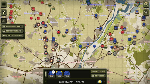
It's WWII - June 6th, 1944. You're a General, and all you have is a map, a radio, and four hundred other players. Will D-Day be a success, or will the Allies be pushed back into the sea?
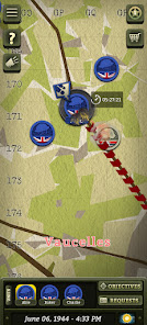
Real-Time General is a massively-multiplayer collaborative strategy game where each campaign lasts TWO-MONTHS in real-time. ALL actions take however long they would in real-life - digging trenches takes hours, fighting can last days.
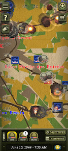
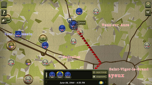
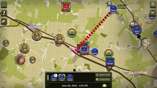
One battalion won't be enough. You MUST collaborate and perform combined-arms maneuvers to achieve your objectives. Schedule artillery barrages, requisition tank squadrons, perform flanks all by communicating with other players. Advance behind rolling barrages, smoke screens, air cover and more!
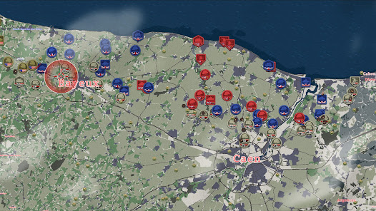
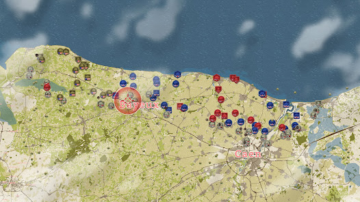
Will you command the U.S. 101st paratroopers? The British Essex Yeomanry artillery regiment? Or the Canadian Fort Garry Horse armoured regiment? There's a role for every play style and every person - Infantry, Armoured, Artillery, Anti-Tank, Headquarters, Intelligence, Engineers, Naval Artillery, Air Support and Logistics. Gain new units and perks as your Battalion gains veterancy. Earn medals and rise through the ranks, eventually earning the right to command other players.
Can't make it to the command tent? The war will go on! Whether you're there or not, the campaign will continue over the course of TWO-MONTHS in REAL-TIME. Queue up commands at the start of the day, check back in later and see how your troops did.
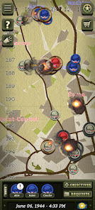
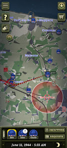
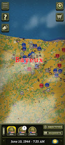
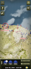
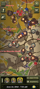
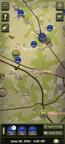
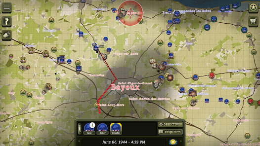
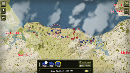
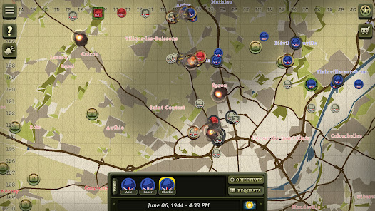
Fight over 30,000+ km2 of detailed countryside modelled using real-world geography. Storm the beaches, fight through the bocage, woodland, swamps and towns of Normandy. Capture key roads, intersections and bridges. Use elevation and lay of the land to plan stunning flank attacks or cunning ambushes.
Real-Time General is a massively-multiplayer collaborative strategy game where each campaign lasts TWO-MONTHS in real-time. ALL actions take however long they would in real-life - digging trenches takes hours, fighting can last days.
One battalion won't be enough. You MUST collaborate and perform combined-arms maneuvers to achieve your objectives. Schedule artillery barrages, requisition tank squadrons, perform flanks all by communicating with other players. Advance behind rolling barrages, smoke screens, air cover and more!
Will you command the U.S. 101st paratroopers? The British Essex Yeomanry artillery regiment? Or the Canadian Fort Garry Horse armoured regiment? There's a role for every play style and every person - Infantry, Armoured, Artillery, Anti-Tank, Headquarters, Intelligence, Engineers, Naval Artillery, Air Support and Logistics. Gain new units and perks as your Battalion gains veterancy. Earn medals and rise through the ranks, eventually earning the right to command other players.
Can't make it to the command tent? The war will go on! Whether you're there or not, the campaign will continue over the course of TWO-MONTHS in REAL-TIME. Queue up commands at the start of the day, check back in later and see how your troops did.
Fight over 30,000+ km2 of detailed countryside modelled using real-world geography. Storm the beaches, fight through the bocage, woodland, swamps and towns of Normandy. Capture key roads, intersections and bridges. Use elevation and lay of the land to plan stunning flank attacks or cunning ambushes.
Oxirgi yangilanish
Xavfsizlik — dastur ishlab chiquvchilar maʼlumotlaringizni qanday jamlashi va ulashishini tushunishdan boshlanadi. Maʼlumotlar maxfiyligi va xavfsizlik amaliyotlari ilovadan foydalanish, hudud va yoshga qarab farq qilishi mumkin. Bu axborot dastur ishlab chiquvchi tomonidan taqdim etilgan va keyinchalik yangilanishi mumkin.


Nima yangiliklar
Fixed error with EU phone localization
Ilova yuzasidan yordam
Dasturchi haqida
Foolish Mortals Games Inc
101-914 Heritage View
Saskatoon, SK S7H 5T1
Canada
+1 306-380-3380


