

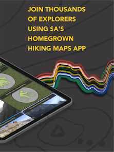
Forge: Hiking Trail Maps

10K+
Téléchargements

PEGI 3
info


À propos de l'application
All Forge trails are digitised and attributed - by our team - with pinpoint accuracy and are regularly updated with input from local conservation agencies and trail managers. With live GPS location, localised emergency contacts and calls, and the ability to download offline maps you can explore with confidence!
Navigate over 6,000 km of trails and 3,200 points of interest across South Africa packaged in simple, easy-to-use maps.
Top features our users love:
• Accurate and up-to-date trails (including 1,400 km across Table Mountain in Cape Town),
• Free offline map downloads,
• Relevant and localised emergency contacts,
• Over 50 interactive nature reserve hiking maps with useful info including permits and fees, contact details and links, parking spots, facilities and more.
Did you know? Forge is 'Made in Mzansi', plus we are the official digital maps partner of CapeNature!
All Forge maps come with helpful tools:
• Basemap toggle (including high-definition satellite imagery).
• Trail and point of interest search,
• Location finder.
Each trail segment is attributed with insightful info bites:
• Name
• Status (Terrain and Open/Closed)
• Difficulty
• Distance
• Mountain Biking (Yes/No)
• Dog Walking (Yes/No)
You can assist in trail conservation and help keep others safe. By submitting a trail issue alert, you can report issues you encounter while hiking so we can update our maps, the hiking community and conservation authorities.
What else you can expect:
• Mountain safety tips,
• Emergency contacts,
• Useful links from the outdoor community.
Visit www.forgesa.com for more info, contact us at [email protected] and stay up-to-date by following us on Instagram, @forge_sa.
Find Your Path. Explore More.
Date de mise à jour
La sécurité, c'est d'abord comprendre comment les développeurs collectent et partagent vos données. Les pratiques concernant leur confidentialité et leur protection peuvent varier selon votre utilisation, votre région et votre âge. Le développeur a fourni ces informations et peut les modifier ultérieurement.

Aucune donnée partagée avec des tiers
En savoir plus sur la manière dont les développeurs déclarent le partage

Aucune donnée collectée
En savoir plus sur la manière dont les développeurs déclarent la collecte
Nouveautés
All round, we’ve made it easier for you to get the most insight and information out of your maps. In this update you can look forward to NEW:
• Filters for properties that allow ‘Dog Walking’ and ‘Mountain Biking’
• Map layers showing difficulty and routes (including distance and elevation)
• Prominent dangerous route symbology
• Simplified map information
• Slicker Topo basemap
We’d love to hear your feedback and suggestions! Leave us a review or email us at [email protected].
Assistance de l'appli
À propos du développeur
FORGE NEW FRONTIERS (PTY) LTD
29 SEAGLADE MILNER CLOSE, MILNER AV
CAPE TOWN
7806
South Africa
+27 84 703 9939


